Two kilometres of flight data: Publication of arguably the largest pool of real-world drone flight measurement data
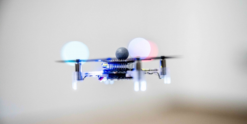
Typically, drone flight data is generated under laboratory conditions – thus limiting its use for real-world application development. A team of researchers from Klagenfurt, working with two researchers from NASA’s Jet Propulsion Laboratory, has now published the first large pool of real-world measurement data. The data was generated in and around the Klagenfurt drone hall and in the context of the AMADEE20 Mars simulation in Israel.
The potential uses of microhelicopters, or drones, are many. However, if drones are to explore disaster areas or deliver packages, they must be able to navigate safely in a variety of environments. In rainy, foggy or windy conditions, over textured or plain surfaces, gazing into the distance or traversing narrow canyons between high-rise buildings: It is not possible to fully replicate real-world conditions in laboratories.
Christian Brommer, Alessandro Fornasier, Martin Scheiber, Jan Steinbrener and Stephan Weiss (all from the University of Klagenfurt), along with Jeff Delaune and Roland Brockers (JPL/NASA), have recently presented the so-called INSANE datasets. The datasets present different scenarios for localisation methods featuring varying degrees of difficulty: These include complex outdoor flights in desert conditions that resemble Mars, as well as flights that involve a drone entering a building from an outside area, which requires a switch in sensing modalities. These flight manoeuvres in particular hold great interest for applications in the smart agriculture sector. Here, miniature helicopters record data from a field in the open air and autonomously fly to a covered area where they are recharged and transmit their data.
To ensure that the team is able to collect the greatest possible volume of data, the helicopter is equipped with up to 18 sensors, three of which are high-resolution cameras for image-based navigation and 3D reconstructions. The data reveals a very precise localisation of the helicopters in the sub-degree and centimetre range, and the speed and vibration dynamics of the vehicle are also recorded.
Christian Brommer underlines the importance of this work for other research teams: “We provide the sensor data in the form of raw data together with the post-processing tools. These findings serve as an important springboard for the development and expansion of novel fields of application.” The data pool will be continually expanded and can be accessed online at https://www.aau.at/en/smart-systems-technologies/control-of-networked-systems/datasets/ .
Christian Brommer, Alessandro Fornasier, Martin Scheiber, Jeff Delaune, Roland Brockers, Jan Steinbrener, and Stephan Weiss. “INSANE: Cross-Domain UAV Data Sets with Increased Number of Sensors for developing Advanced and Novel Estimators.” arXiv, Oct. 17, 2022. doi: 10.48550/arXiv.2210.09114.


 Drohnenhalle | Foto: aau/Waschnig
